
Our Team


(photo credit: A. Benson/Marstel-Day).
Marstel-Day works closely with our clients to develop strategic conservation plans based on analyzing environmental and ecological contexts, operational and regulatory constraints, stakeholder interests, and collaborative conservation partnership opportunities. Our planning experience spans across terrestrial and aquatic ecosystems and across multiple spatial scales - individual sites, large landscapes, regions, nationwide, and international.
Our conservation staff excel at supporting our clients in the development and execution of conservation and natural resources management programs, measuring the impact of these programs, and engaging stakeholders for collaborative conservation efforts. In addition, Marstel-Day's environmental policy specialists have extensive experience in designing policies and ensuring environmental regulatory compliance to support effective conservation and natural resources management.
Capabilities/Services
- Landscape Conservation Plans
- Climate Adaptation Planning
- Natural Resources Management Plans
- Endangered Species Management Plans
- Invasive Plant Management Plans
- Forest Management Plans
- Pollinator Habitat Conservation Plans
- Land Conveyance Strategies and Implementation
- GIS-based Land Protection Planning
- Scenario-based GIS Conservation Modeling Tools
- Programmatic Strategic Planning
- Programmatic Measures and Evaluations
- Encroachment and Conservation Partnering Solutions
- Strategic Communications and Stakeholder Engagement
- Habitat Restoration and Management
- Wetlands and Stream Restoration
- Environmental Education and Outreach
- Policy Development and Analysis
- ESA Section 7 Consultations and Biological Assessments
Related Projects
- Integrated Natural Resources Management Plan (INRMP) Update and Climate Considerations Integration, Naval Support Activity Annapolis (Maryland)
- Pollinator Habitat Conservation Plan, Naval Support Facility Dahlgren (Virginia)
- Invasive Plant Management Plan, Joint-Base Anacostia Bolling (Washington, DC)
- INRMP, Endangered Species Management Plan Update, and Climate Adaptations for Natural Resources, Sea Girt National Guard Training Center, Army National Guard (New Jersey)
- Integrated Forest Management Plan Updates and Climate Considerations Integration, Naval Support Facility Indian Head and Naval Support Facility Dahlgren (Maryland, Virginia)
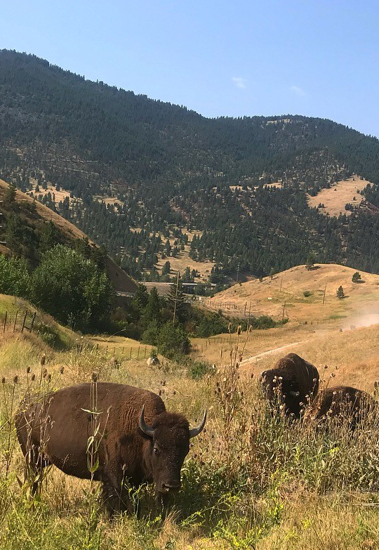
- National Bison Range Comprehensive Conservation Plan and Environmental Impact Statement, U.S. Fish and Wildlife Service (Montana)
- San Luis National Wildlife Refuge Complex Comprehensive Conservation Plan and NEPA Support, U.S. Fish and Wildlife Service (California)
- Strategic Conservation Plan and Scenario Planning Tool, New River Land Trust (Virginia)
- Invasive Plant Management Plan, Surveys, and Control at Joint Base Anacostia-Bolling (Washington, DC)
- Natural Resources Interpretive Displays, Naval Support Activity Bethesda (Maryland)
- Landscape Conservation Cooperative Network Strategic Plan, Performance Evaluation Framework, and Annual Workshop Facilitation, U.S. Fish and Wildlife Service, Science Applications, Headquarters
- Migratory Bird Treaty Centennial Strategic Plan and Implementation, U.S. Fish and Wildlife Service, Migratory Bird Program, Headquarters
- International Wildlife Conservation Strategic Plan, U.S. Fish and Wildlife Service, International Affairs, Headquarters
- Nationwide BASH Probability Model and Programmatic Biological Assessment for 35 Federally Protected Species, U.S. Air Force, Omaha District
- Endangered Species Management Plan Update and Biological Assessment, U.S. Army Garrison Presidio of Monterey (California)
- National Wildlife Refuge Hunting and Fishing Plans and NEPA Compliance Support, U.S. Fish and Wildlife Service, Region 6
- U.S. Marine Corps Natural Resources Management Policy, Marine Corps Order 5090.2 Volume 11, Headquarters Marine Corps, Pentagon
- U.S. Coast Guard Natural Resource Management Policy and Guidance Document for Shore Unit Natural Resources Management, Commandant Instruction Manual M5090.3
Solutions & Innovations

Our experts have decades of experience in conducting ecological studies, such as biological surveys, environmental monitoring, and species-habitat suitability modeling. Our field biologists are trained and skilled in rare, threatened, and endangered (RTE) species surveys; ecological monitoring design; and GIS mapping and modeling across terrestrial; riverine; and coastal ecosystems.
Capabilities/Services
- RTE Species Surveys
- Invasive Species Inventories
- Fauna and Flora Surveys
- Forest Inventories
- Wetlands Identification and Delineation
- Ecosystem Services Valuation and Trade-offs
- Species-Habitat Suitability Models
- Bird Aircraft Strike Hazard (BASH) Assessments and Models
- Integrated Field Data/GPS Tablets for Efficient Data Collection
- GIS-based Mapping, Modeling, and Analysis
Related Projects
- RTE Plant and Bird Surveys, Naval Support Activity Annapolis (Maryland)
- Pollinator Insect Surveys at Multiple Military Installations, NAVFAC Washington (Maryland, Washington, DC)
- Bat Surveys at Multiple Military Installations, NAVFAC Washington (Maryland, Virginia, Washington, DC)
- Sensitive Joint-Vetch Habitat Suitability Mapping, Marine Corps Base Quantico and Naval Support Facility Dahlgren (Virginia)
- Invasive Plant Surveys and Invasive Plant Management Plan Update, Naval Air Station Patuxent River (Maryland)
- Forest Inventories, Naval Support Facility Indian Head (Maryland) and Naval Support Facility Dahlgren (Virginia)
- Acoustic Avian Surveys, Naval Support Facility Carderock (Maryland)
- Wetland Delineations, Shaw Air Force Base (South Carolina)
Solutions & Innovations